
Photography: Chile 2005From San Carlos de Bariloche in Argentina, we caught a bus across the Chilean border to Puerto Montt. There followed some really quite unremarkable days on Chiloe island and around Puerto Montt, neither being in my opinion worth the visit. We then caught a three-day boat trip down to Puerto Natales, for a four-day hiking trip in Torres del Paine National Park.
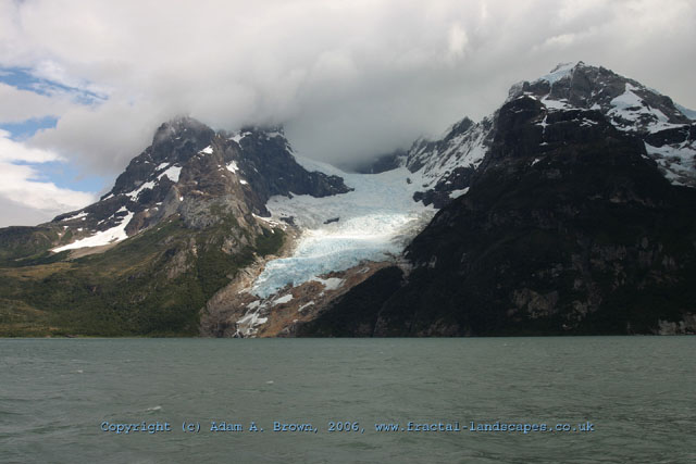
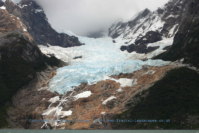
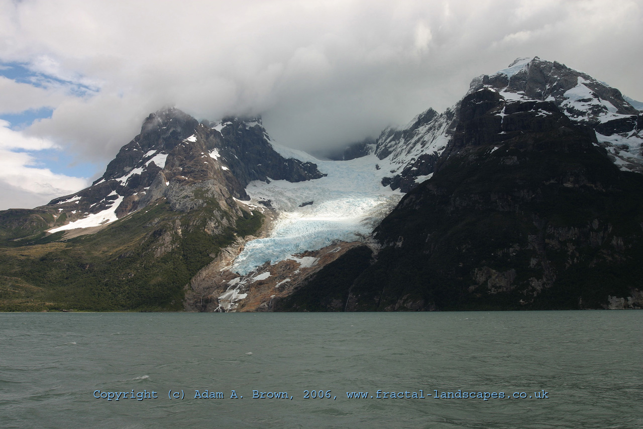
To get from Puerto Natales to Torres del Paine, we took a boat trip along the remarkable Sono Ultima Esperanza (Last Hope Sound). This is a stretch of saltwater, accessed from the Pacific side of the continent via a network of narrow fjords, which is to the east of the main range of the Andes. The northernmost tip of the sound is in Bernado O'Higgins National Park. Monte Balmaceda rises out of the sea here like some broken volcano, alpine glaciers spilling down its slopes. The views here show the Balmaceda glacier. It is easy to see just how far the glacier has retreated in recent years - only 15 years ago, it met the sea at the base of the mountain. Now there is a huge expanse of exposed rock, the light colour indicating that even mosses have yet to establish themselves. After seeing the glaciers on Monte Balmaceda, we headed up river in a Zodiac to the south of the Torres del Paine national park. This park is at one edge of the Southern Patagonian Ice Field (the third largest ice field on the planet), meaning that truly colossal glaciers come down from the mountains to the West of the park, and feed its many lakes with icebergs and meltwater. The park itself is named after three distinctive mountains, the "Towers of Paine", which form part of the central upthrusting of the park. This small range of mountains, younger by far than the nearby Andes, form some of the most dramatic terrain to be seen anywhere in the world. On our first full day in the park, we did a section of the famous "W" walk that runs along the base of the Paine massif. This took us into the Valle Frances (French Valley), which runs between Paine Grande to the West and the Cuernos del Paine to the East.
Heading towards the Valle Frances. This view shows the entrance to the valley to the left of the picture, in front of the imposing Cuernos del Paine mountains. In the foreground, the water of Lago Scottsberg is whipped up by the ever present West wind. The forest rising up the mountains is an immature forest of Southern Beech, currently recovering from a destructive burn-back by the first landowner in this area. Thus, the trees are only perhaps one quarter of their full adult height.
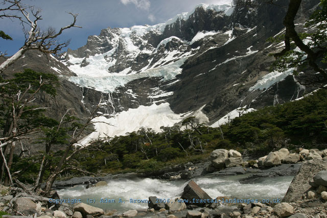
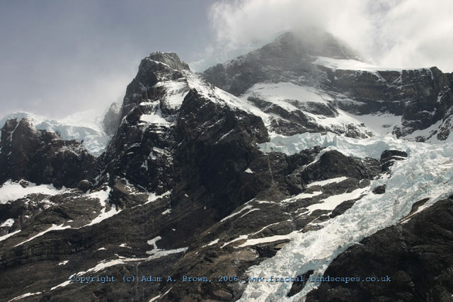
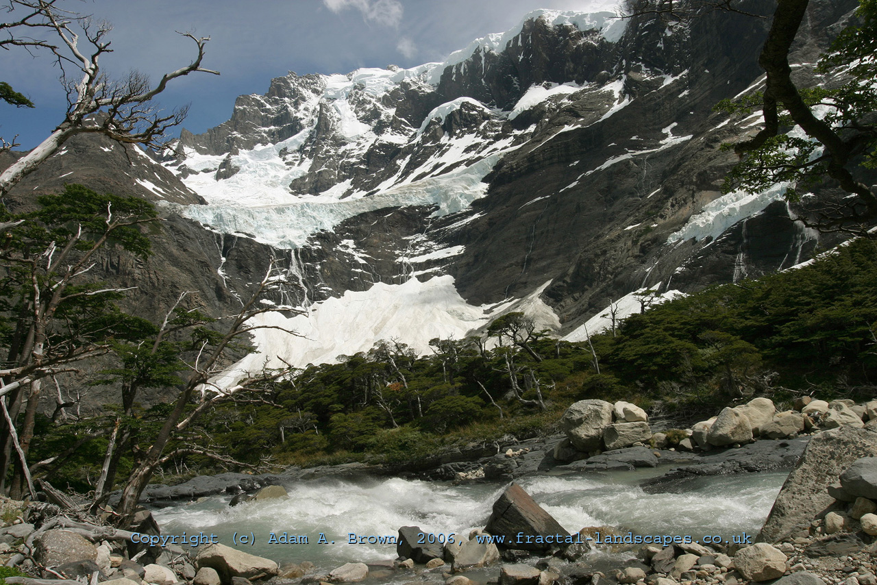
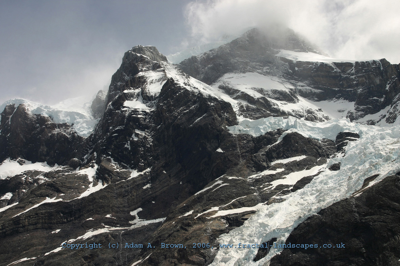
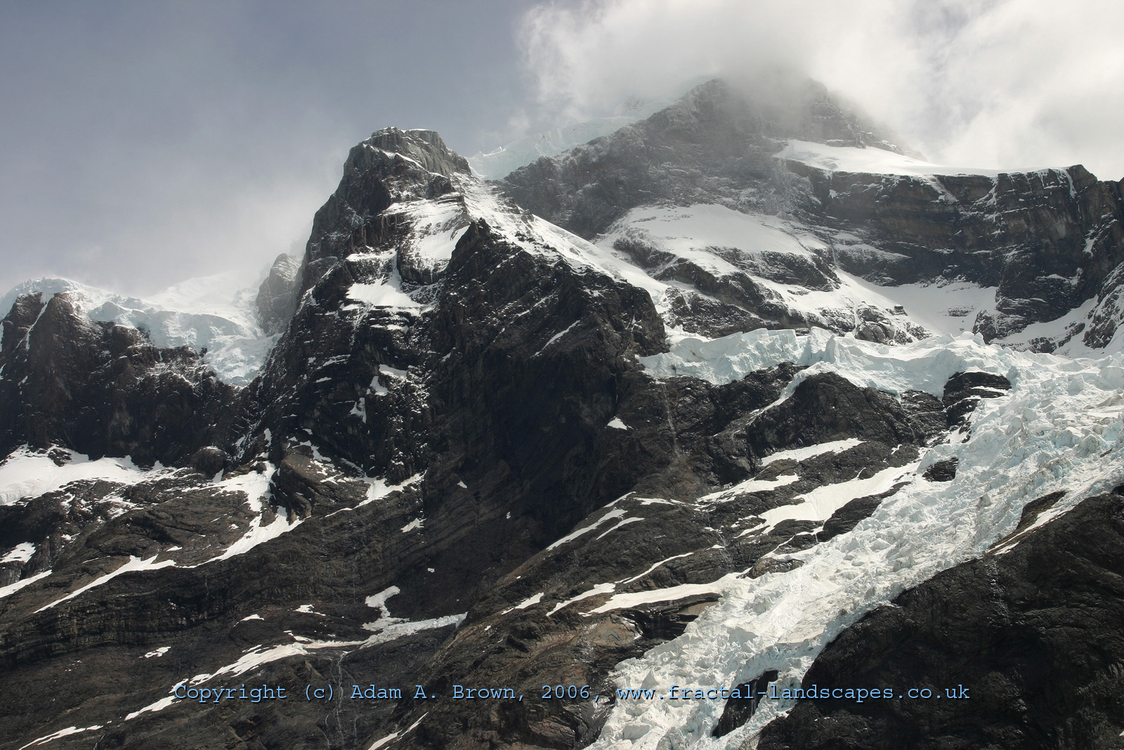
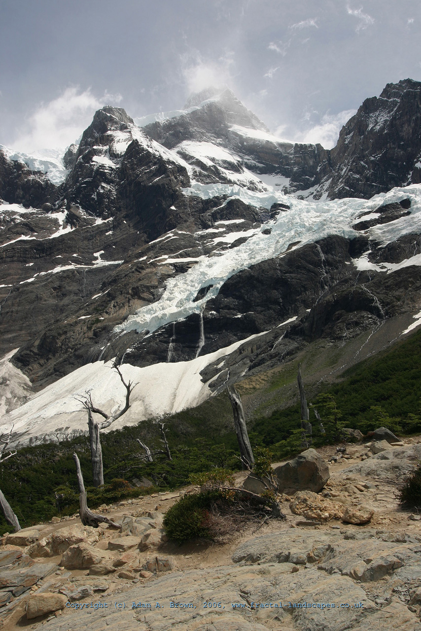
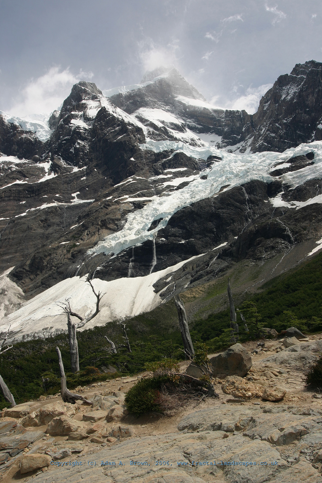
From the Valle Frances itself, the high alpine glaciers of Paine Grande loom high above. The impressive 2000-meter cliff of the east side of Paine Grande, carved by the French Glacier over the years, forms a giant natural auditorium which echoes with the thunderous sound of ice avalances as the glaciers break up and retreat in the face of global warming.
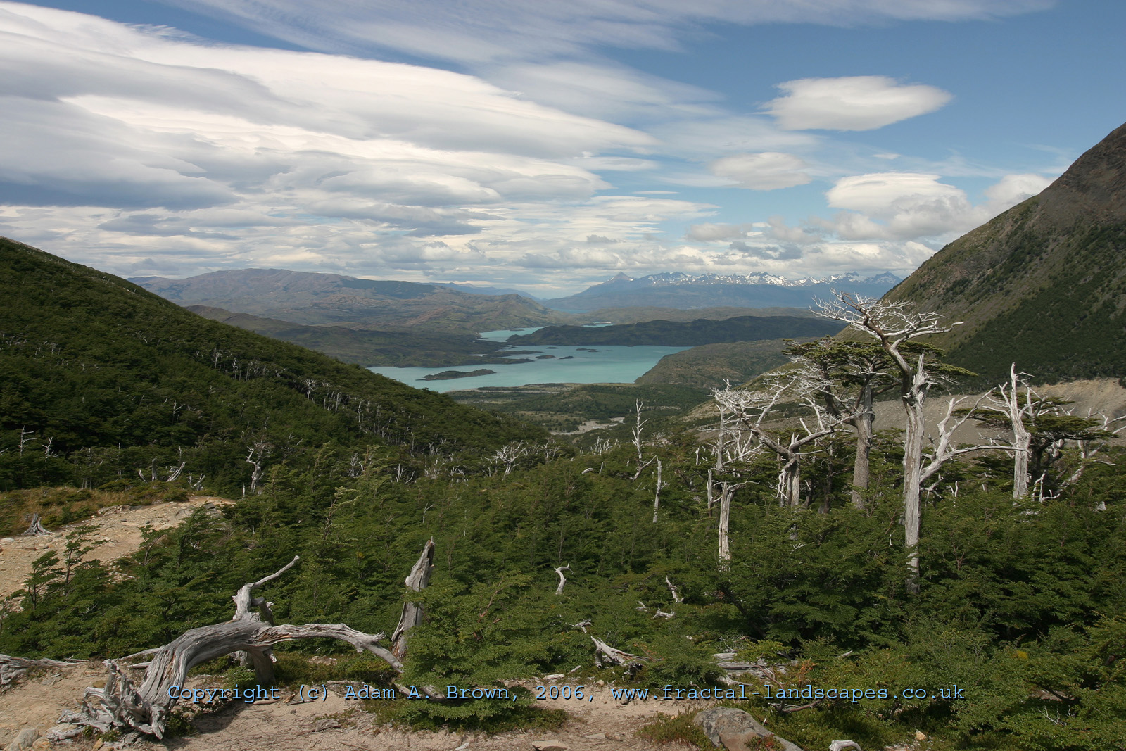
Looking south from the French valley affords an excellent view over the southern part of the park. The winds whipping across the park from the West carry moisture from the Pacific. When this air hits the 3000-meter high Paine Massif, it is forced upwards, and the water condenses to form huge lenticular clouds. Much of the time, the same phenomenon leads to persistent rain and cloud cover, but we were lucky enough to have good weather for the duration of our stay. In the above photo, the husks of burnt-back trees from over 100 years ago are still scattered through the forest. Occasionally, one survived the destruction.
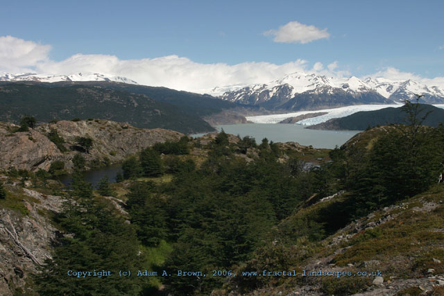
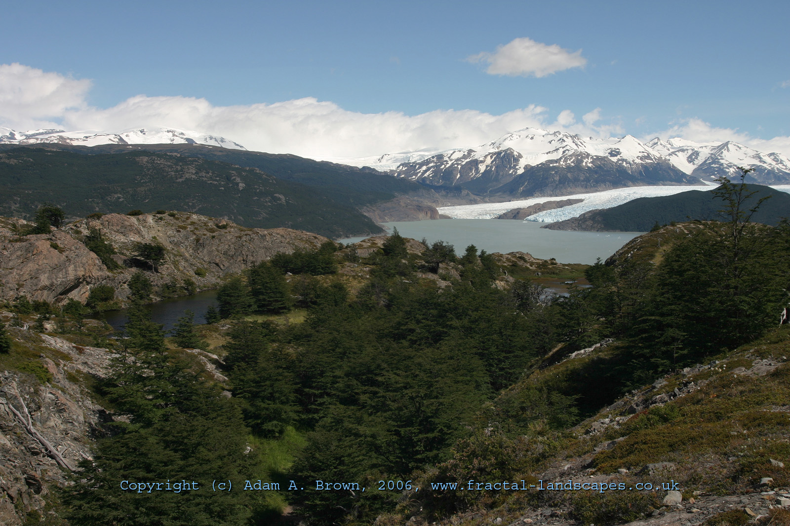
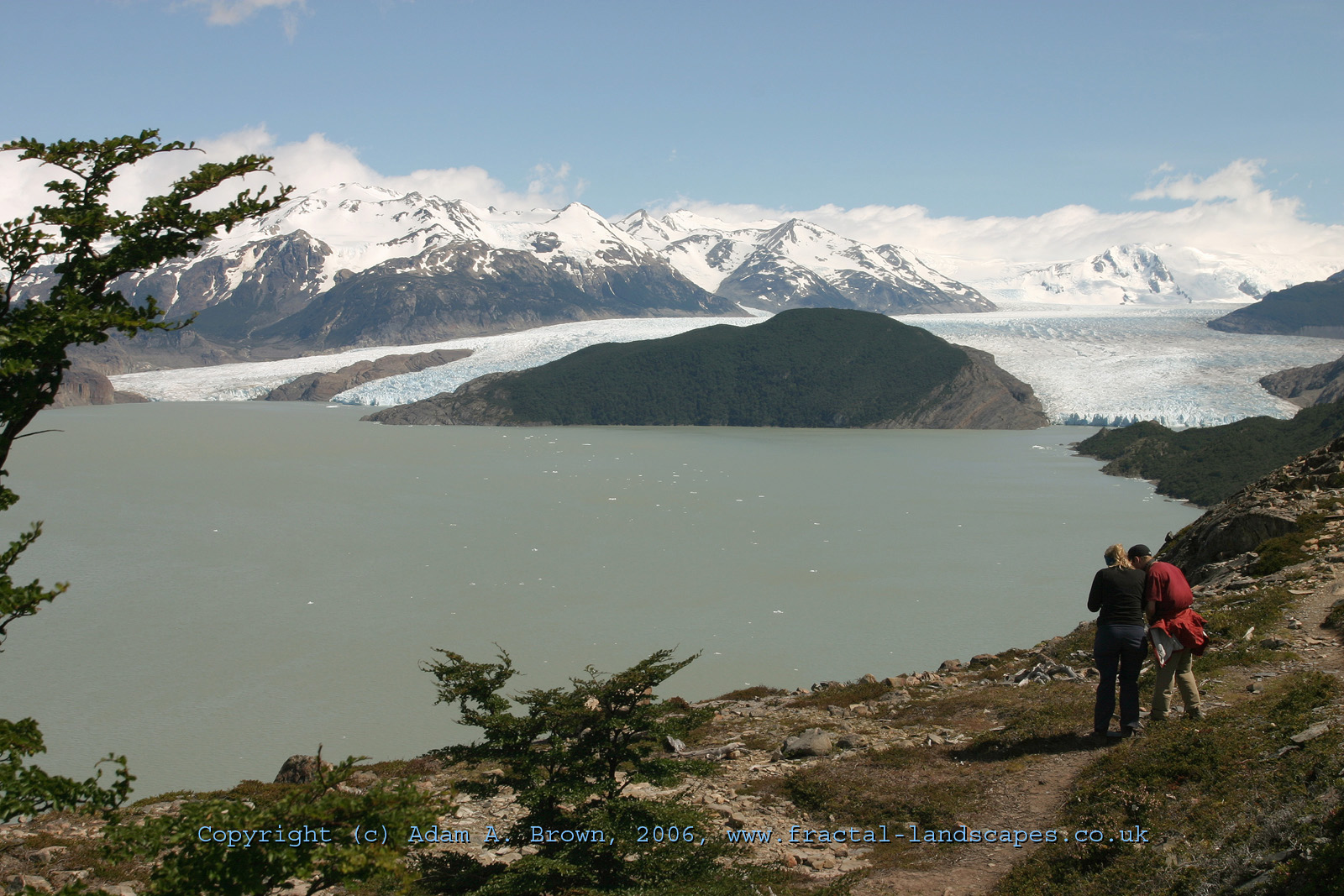
On our second day, we headed to the Encampamiento Grey, and the Grey Glacier, one of almost 50 glaciers that descend from the Southern Patagonian Ice Field. In the first photo was our first view of the glacier on the walk from the previous evening's camp. In the second photo, Dan advises Kylie how best to capture the view. It is clear to see the true scale of the glacier, set against the mountains around and its lake below.
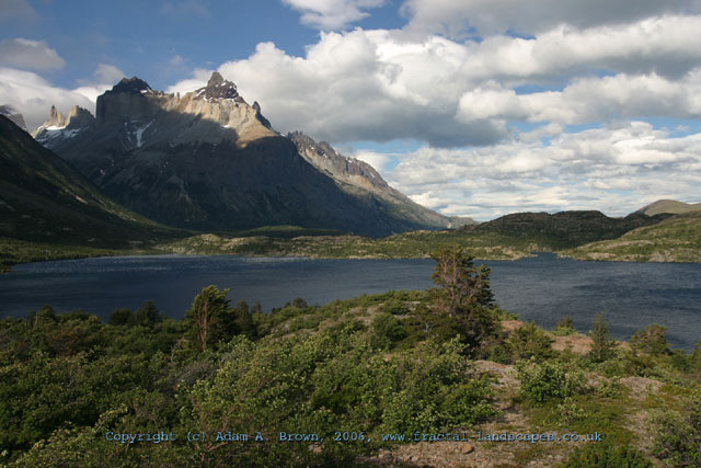
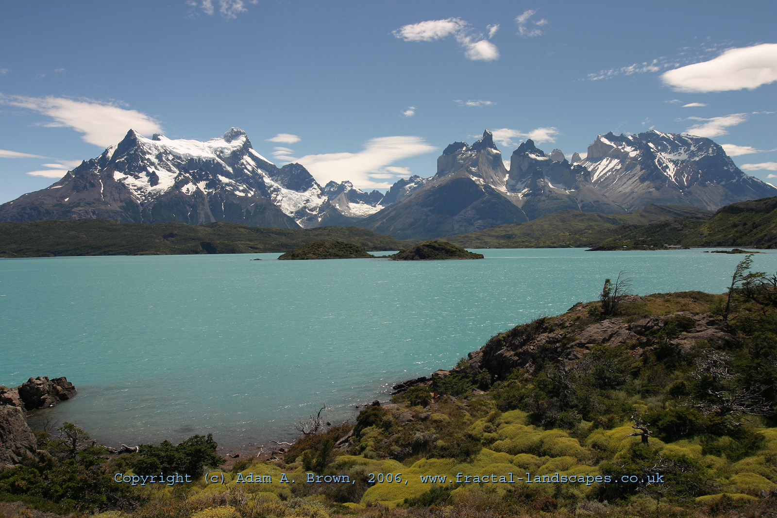
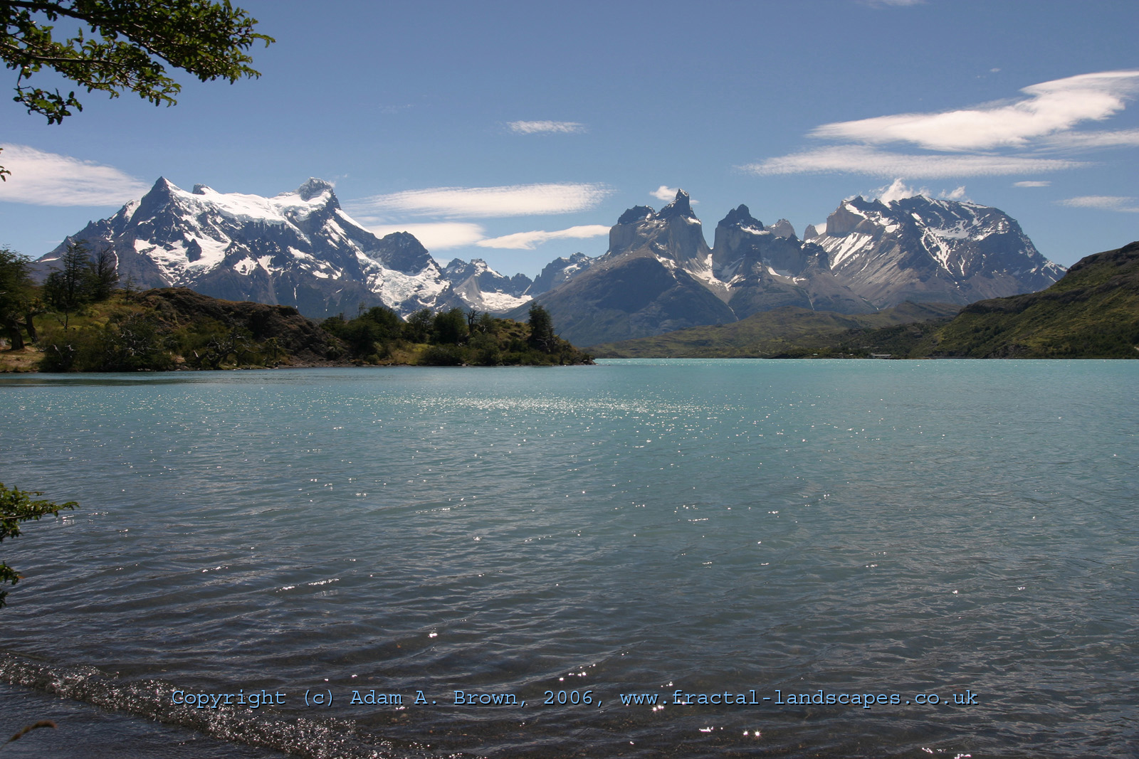
The two views above show the whole Paine massif, with the peaks and alpine glaciers of Paine Grande to the left, and the Cuernos del Paine to the right. The tips of the Torres are just visible behind. The lake in the foreground is Lake Pehoe. The glacial sediment gives the lake a turquoise colour.
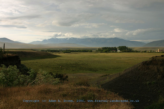
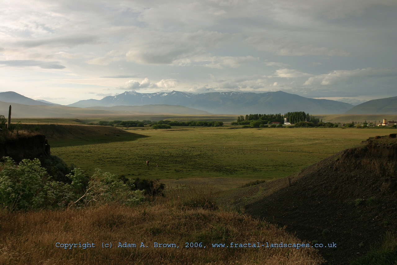
Just after leaving the park on our last day, I took this photo of the typical patagonian countryside. The main agricultural activities here are the raising of sheep and cows. |


